Via Romea Germanica IX
Termeno, Italy to Salorno
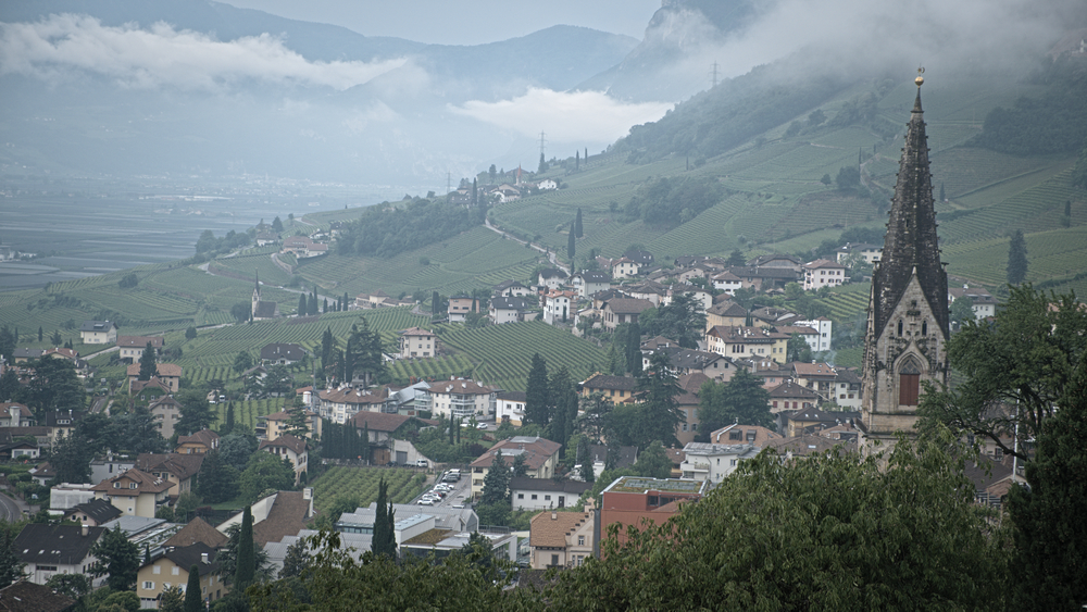
On the Road to Salorno.
We awoke to the sound of angels bowling in the mountains. Lightning splintered over the high peaks, and the resulting thunder smashed, ricocheted, and echoed in the canyons. On the hillside above us the bells of San Giacomo’s church tolled plaintively. A fell wind drove dark clouds toward Termeno, and within minutes a heavy rain began to fall.
Welcome to the Peripatetic Historian's multi-part series about hiking the Via Romea Germanica.
If you have stumbled across this installment by accident or a fortuitous Google search, and have no idea what is happening, you might prefer to begin at the start of the series, here: Introduction to the Via Romea Germanica
Otherwise, let's return to our story, already in progress.
By the time we finished breakfast, the rain had stopped, so it was once more into our backpacks and hiking shoes. Another day on the road beckoned. Our guidebook described today’s stage as short and easy. No more than a 17 KM jaunt, mostly flat. Neither of these claims proved accurate.
We decided to get our blood pumping by climbing the hill that led to the church of San Giacomo. The church occupies a privileged position looking out over town. Our guidebook suggested that San Giacomo was a common stop for pilgrims on their way to Rome. San Giacomo (Saint James) is the patron saint of the more famous Camino de Santiago; I don’t know how much time he devotes to watching over hikers on the Via Romea Germanica — it is probably only a part time gig. Nevertheless, any help is always welcome and it seemed like a good idea to touch base with him and secure his blessings on our endeavor.
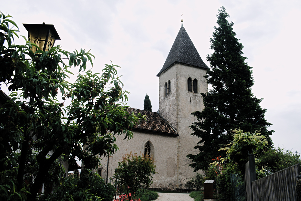
The Church of San Giacomo
A placard on the outer wall announced that the church did not open until 10:00 AM. It was only 9:00; we didn’t have time to hang around for an hour. Fortunately, being a long-time skeptic, I walked over, pushed on the church door, and it opened easily. Not only that, but the church had motion-activated interior lighting, so visitors could admire the frescoes adorning the walls.
The earliest reference to this church comes from the year 1214. The romanesque frescoes date from the thirteenth century. They are a surrealistic mix of angels, demons, and biblical scenes.
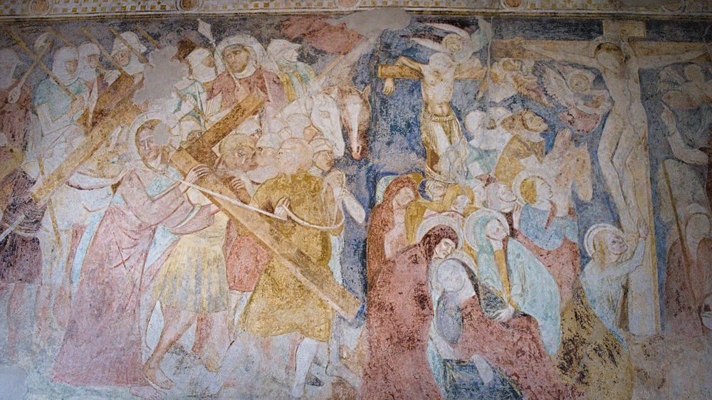
Medieval Fresco.
We gazed upon the medieval art for a quarter hour, and then hitched up our backpacks and resumed our walk.
As noted above, today was supposed to be a fairly easy day. The elevation diagram in the guidebook makes it appear that the route is almost flat. In the interests of those pilgrims who will follow in our footsteps, let me note that this optimistic depiction of the track’s elevation is desperately misleading. The route from Termeno to Magre returns to the earlier Via practice of tracking up and down hills through vineyards. What is supposed to be flat, is, in fact, a fairly consistent 8 KM roller coaster, a land of constant elevation changes. The reason this segment looks relatively flat in the guidebook, is that the authors have used a different scale than they use on the other pages. The Y axis of the graph depicts elevations from 0 to 1600 meters on the page describing this stage, while the previous day’s stage has a scale that only runs from 0 to 600 meters. The result is that today’s stage was very compressed compared to yesterday’s, and consequently, what would have appeared as a stage with significant peaks and valleys (on yesterday’s scale) appeared deceptively flat. The first half of the stage consists of rollicking hills, reaching heights of 385 meters in places.
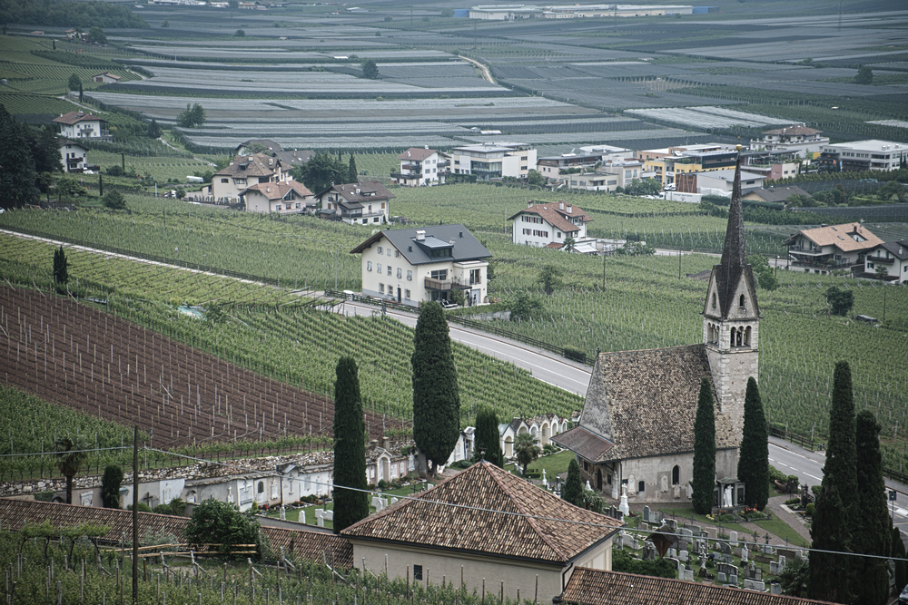
How did that church get beneath us?
The moral of the story is to check the guidebook scale before drawing conclusions about how easy a stage will be. We had expected a pleasant stroll through flat county, rather than a challenging hill walk. Even the ever-cheerful Mary looked like some air had been let out of her tires by the time we reached Magre.
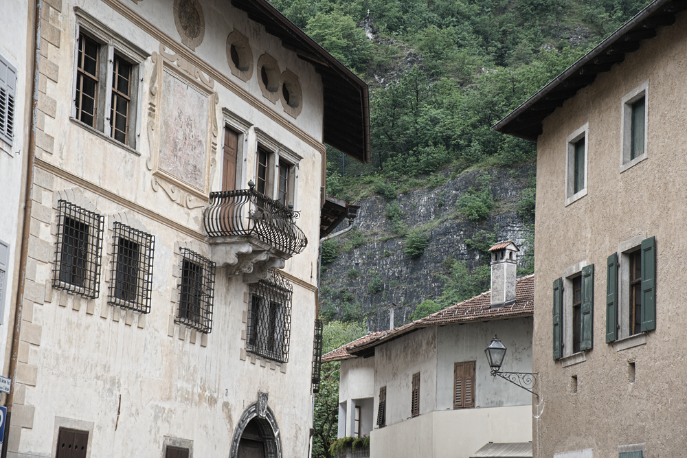
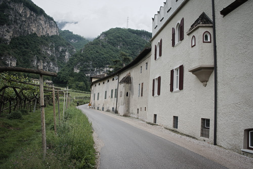
One of the things that’s distinctive about this region, is the size of the houses. These old stone houses are massive fortresses, three and four stories high. I imagine they were built in a time when families were larger, or perhaps they were designed to house servants as well. In either case, they are amazingly large.
The farmers were busy in the fields today. I saw one man dragging a long hose up and down the long rows of vines, spraying his crop on foot. Another man was trimming vines; someone else was lugging 75 lb bags of fertilizer down a hill from a truck. This is a labor intensive business, and that is even before the harvest begins. A lot of hard work goes into that glass of wine.
Cortaccia, one of the towns on today’s route, is aesthetically pleasing, while still very much an agricultural town. The buildings are old, large, and ornate stone edifices. Nevertheless, in the under spaces that probably once housed animal stables, we saw tractors and farm equipment. The tractors roaring by in the streets, pulling sprayers and fertilizers, reminded us that this was a farm town, albeit a very beautiful community.
After several ascents and descents, we finally approached the town of Magre. This required a long, foot-pounding descent on a hard concrete road. My feet were singing the blues by the time we regained the valley floor.
At about the same time we reached Magre, the rain began to sprinkle. We enjoyed a light spritzer of rain the rest of the way to Salorno.
The stage flattened after Magre. We crossed the valley, passing through fields of almonds (who eats all of these almonds?) and at last made it to the Adige river and the bike path into town.
Here is another crucial decision that the pellegrino should consider. Shortly after joining the bike path (which my GPS calculated would reach Salorno in slightly less than 6 KM of flat walking beside the Adige river), the Via suddenly makes a left hand turn to begin a long looping curve to the east, following the base of the mountains, into Salorno.
Here is what you need to consider: the bike path is short and direct, the quickest route into town. The loop along the mountains, while taking one through many scenic vineyards (although some might think that by this point they had already seen far more vineyards than a person can reasonably be expected to appreciate in any given day), is much longer and doesn’t seem to offer any real added value to the day. It is almost all on a hard concrete road, which also brings you into contact with occasional motor traffic, and it is a bit mystifying why this long diversion is specified for the hiker. It is beautiful, but so is walking on a bike path beside the majestic Adige river.
So there is something to think about. We took the long (scenic) way into town, but I wonder if it was worth it.
I do so love rivers. And bike paths.
After our recovery period, we took a short walk around Salorno, in advance of dinner. Like some of the other towns we had passed through today, it was a strange mix of older, elegant buildings, and agriculture. I don’t know why I find this so peculiar. I associate beautiful medieval buildings with well-preserved and heavily visited places like Venice or Florence. I always think of farmers as living out in the countryside, among the fields. But here in Salorno, as in Magre earlier in the day, you are just as likely to be run over by a tractor as an automobile. The farmers zip up and down Dr. Josef Noldin street at high speeds, towing trailers or crop sprayers behind their tractors.
On a Friday evening, they assemble in a bar down by the Statale. We were a little early for the restaurant opening, so we decided to pop in for an appertivo. A group of sun-roughened farmers had taken all of the seats outside the bar, so we went inside. More farmers. In the back room where we finally found seats, groups of farmers sat around tables playing cards. I don’t know if this was a regular Saturday night gathering or if it happened every night, but it was nice.
Today's distance: 19.6 KM; Total distance: 163.36 KM
If you are enjoying this series, why not subscribe to Richard's monthly newsletter, What's New in Old News? The Peripatetic Historian is on the road, roaming the world and compiling fresh adventures. Don't miss out. Click here to join the legions of above-average readers who have already subscribed.