Via Romea Germanica VIII
Bolzano, Italy to Termeno
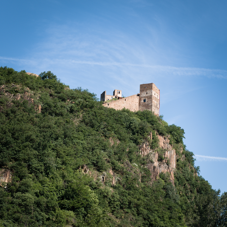
Castel San Firmiano, Bolzano, Italy.
Led astray by my GPS on the outskirts of Bolzano, we had ventured through an open gate in a high chain link fence. The trusty GPS indicated we just needed to walk to the other end of a short dirt road, and we would emerge back upon our designated route.
We took its advice.
The road abruptly terminated, facing an impassable gate, a barrier designed to exclude the public. “Obviously this won’t work,” I muttered to Mary. We turned back, retracing our steps.
When we reached the end of the road where we had begun, we were horrified to see the gate we had passed through was also shut.
We were trapped — two mice in a large chain link cage!
Welcome to the Peripatetic Historian's multi-part series about hiking the Via Romea Germanica.
If you have stumbled across this installment by accident or a fortuitous Google search, and have no idea what is happening, you might prefer to begin at the start of the series, here: Introduction to the Via Romea Germanica
Otherwise, let's return to our story, already in progress.
This morning we cinched backpacks over our shoulders and returned to the Via. Our destination was Termeno, Italy, or to give it its full and proper name, Termeno sulla Strada dello Vino (Termeno on the Street of Wine).
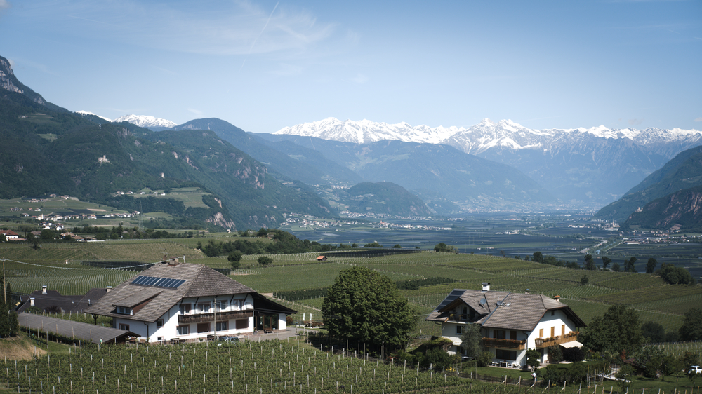
Growing grapes in the shadows of the mountains.
The guidebook rates the difficulty level of this stage “medium.” There is only a 650 meter altitude gain, but the day’s hike is longer than anything we have walked on the Via so far (26.1 KM / 16.2 Miles).
The short term weather forecast was promising: sunshine for the day’s journey with a high temperature of around 65 F. Very pleasant walking conditions. The longer term forecast, however, was not as optimistic: a week of rain for the region. Nevertheless, on the Via we live our lives one step at a time. Don’t borrow sorrow, rain, or a steep hill, from tomorrow.
Bolzano is a bikers’ dream. The city is linked with a network of bike routes, and this morning, everyone was out for their two-wheeled morning commute. Bikes whizzed by on every side of us, carrying the city’s people to their destinations. The emphasis on two-wheeled commuting is undoubtedly one of the main reasons that everyone looks so healthy and fit in this city.
We departed the city on a three lane human-powered highway: two lanes were set aside for bikes, one for pedestrians. I followed the waymarks that I had programmed into my GPS to lead us out of town. Everything was going swimmingly, until the GPS decided to lead us away from the bike path (advice for future Via hikers: stay on the bike path as you leave town. Do not leave the bike path!)
When I reviewed the error later, I determined that I should have enter more waypoints to follow the route of the bike path. Lacking these intermediary points, the GPS decided that it would be more efficient to cut a corner. It led us away from the bike path, through the outskirts of Bolzano on a main road. Eventually we reached a point where we could see Castel San Firmiano ahead of us. Since the fortress was one of the first scheduled attractions of the day, this lulled us into thinking that we were on course. In fact, the GPS had led us to the edge of a large almond farm, that stood between us and the castle. No problem, said the GPS, just follow this little road (Via Bivio) through the almond farm. We passed through the aforementioned open gate, walked about 300 meters on the Via Bivio, and then came to a series of signs that said we were on private property, and we needed to turn around and get out.
Rats. The GPS had said nothing about this being a private road. And so, with tears in our eyes, we reversed course and returned the way we had come. When we reached the end of the street, however, the gate, that had been open minutes earlier, was now firmly closed. It was a large gate, perhaps seven or eight feet tall. It had iron spikes tack welded in a menacing row across its top. Most vexingly, it sealed the high fence perfectly. A quick examination revealed that it required a key to energize the motors that swung it open. In other words, we were trapped.
This was not good. I rang the doorbell of the only house at our end of the compound. No one answered. Despair seeped into the cornices of our hearts.
Then, like an answered prayer or an errant superhero, we heard a noise in the distance, and saw something flying up the road toward us. It was a young woman on a Segway. She dashed up beside us and braked to a stop on her two-wheeled steed. I attempted to explain our predicament in my fractured Italian. She quickly assured us (in English) that this happened all the time. Nevertheless, we would have to walk around the edge of the fenced almond plantation and rejoin the bike path. She employed her magic key, the gate swung open, and we were freed.
Huzzah!
The GPS shortcut added an extra 3 KM to our day’s hike. Nevertheless, as Ma Ingalls always used to say, “All’s well that ends well.”
We passed beneath the hillside that supports the Castel San Firmiano. The Adige River curls around the castle’s base, and we walked (on the bike path) beside rows of apple trees.
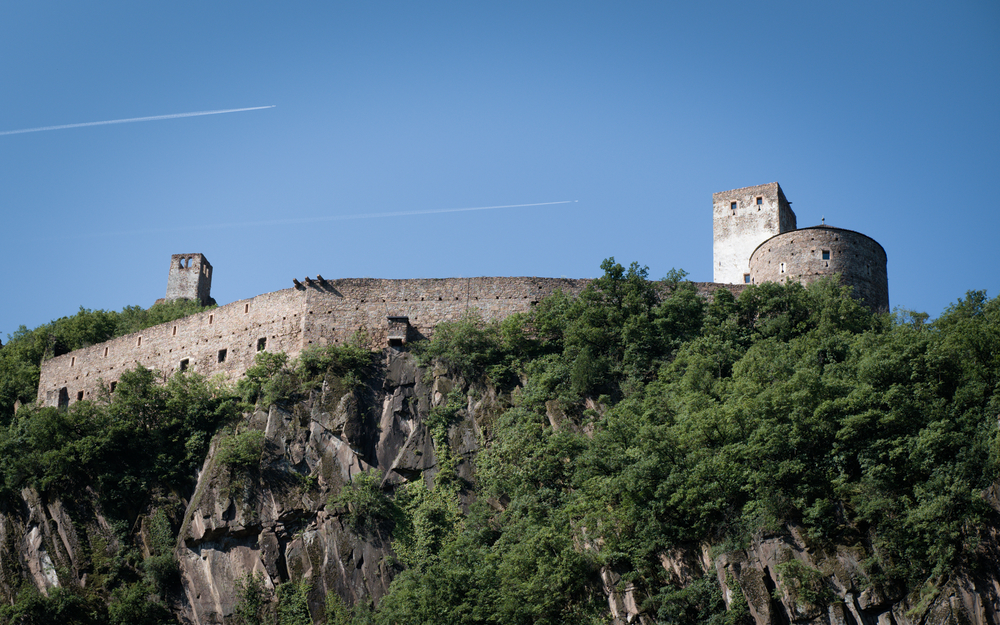
Castel San Firmiano a.k.a. Messner's Mountain Museum.
The decommissioned castle has been turned into a tourist attraction: Messner’s Mountain Museum. Established by mountain climber Reinhold Messner, the castle is one of six museums he has established, each of which is devoted to climbing. We hiked up the entrance, but balked when we saw the the entry fee was twelve euros each. I find mountaineering interesting in an abstract way, but I certainly didn’t want to shell out twenty-four euros to find out more about it (especially on a long day in which my little GPS mishap had already put us behind).
We continued to climb a moderate grade that ran through lovely, shady pine forests. The sun was out, and dappled light spotlit ferns and funghi in the woods around us. Occasionally we strolled beside vineyards or almond orchards.
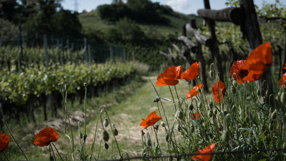
Poppies guard the vineyards on the road to Termeno.
Our destination was a couple of lakes, beginning with Lago di Monticolo. This was to be a little more than halfway along the day’s stage. We found it with no problem (the GPS doing a nice job of sorting out the turns on the trails). Since we had already burned quite a few calories in our long morning, we opted to pull into a lakeside restaurant for a break. We had a light lunch: a liter of water, a plate of french fries, and I had a glass of chilled Prosecco. I am starting to think that Prosecco is going to become my afternoon drink. I do not normally like white wines, but I love the tart chill of Prosecco, straight from the refrigerator. I also enjoy the little frizzante—the tart bubbles that chew lips and tongue. A very satisfactory drink on a warm day, and just the thing to set one up for the second half of the stage.
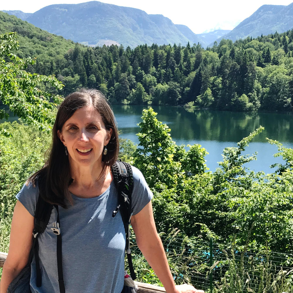
Mary taking a break at Lago di Monticolo.
We continued hiking. Our path had been largely uphill since leaving Bolzano, and now it turned sharply downhill. We quickly gave up all of the meters in our altitude bank, dropping toward the next lake on our itinerary, Lago Caldera.
Lago Caldera proved to be much larger than Lago di Monticolo. It was also rather different in that it is set in the valley bowl, amid vineyards, rather than nestled in a forest like Monticolo. The heat had turned relentless as we slowly beat our way down through the vineyards and past the resort that squats at the northern end of the lake. There were several hotels, marinas, RV camp sites, and a couple of bars where we could have stopped for another refreshing glass of Prosecco. However, with Termeno and the end of our day rapidly (?) approaching, we chose to press on.
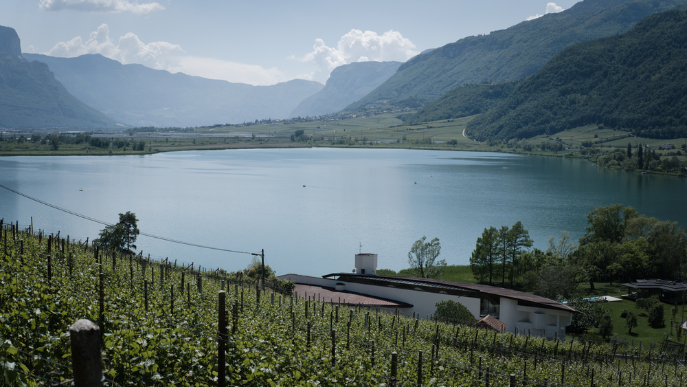
Lago Caldera
The bike path parallels a very busy state highway out of the resort. Cars, trucks, and large tour buses rushed beside us as we beat our feet against the pavement. It wasn’t even close to the most pleasant walking of the day. The guidebook offered a solution: we could follow the bike path into Termeno, or we could take an off-road route that ran over an intervening hill and (promised the book) reduced the distance by 500 meters.
That sounded good to us. We crossed the busy road, and then squeezed along a dangerously narrow shoulder to the place where the “Wanderweg Kalter See” departed for an overland journey to town.
In the hope of being able to offer some useful advice to future travelers along the Via, let me just encourage you to think carefully about this route. It was far more picturesque than the bike route. It was also very hilly, with steep uphill and downhill segments that paralleled some of those we found in the approach to Bolzano.
Solitude compensates for the punishing nature of this diversion. We saw no one else on the path the entire time. The route also offers scenic views (undoubtedly nicer than the bike path), and some organization has placed a series of placards along the route explaining and identifying the flora and fauna one encounters in these woods. So, it could be an educational experience as well.
These positives must be balanced by the fact that it is a tough walk when tacked onto the end of a long stage. I was pretty tired by this point and found myself longing for the smooth, flat bike path.
In any case, both routes reach the same point, and with the afternoon sun declining and cumulonimbus clouds gathering over the peaks, we made our way into Termeno.
Daily Distance: 30 KM; Total Distance: 143.76.
If you are enjoying this series, why not subscribe to Richard's monthly newsletter, What's New in Old News? The Peripatetic Historian is on the road, roaming the world and compiling fresh adventures. Don't miss out. Click here to join the legions of above-average readers who have already subscribed.