The Salish Sojourn VI
Victoria, British Columbia
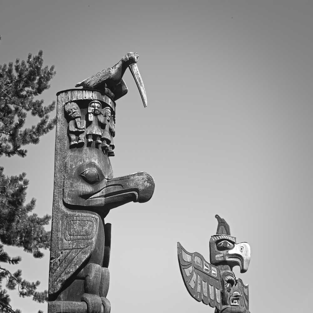
Totems, Thunderbird Park, Victoria, BC
Victoria is a vibrant city, one of bicyclists, walkers, and other outdoor enthusiasts. The Inner Harbour is ringed with trails, and in the morning and evening, the bicycle commuters flow through the streets. Victoria is so committed to cycling that at one bike shelter, there is a collection of bicycle repair tools — wrenches, screwdrivers, and other implements of resuscitation — each connected to a long twisted steel cable that guarantees utility while deterring thievery.
On an overcast morning, with rain threatening, we decide to take a hike along one of Victoria's premier biking routes, the Galloping Goose Trail. This trail connects Victoria to the town of Sooke, 36 miles west of the city. Thousands of bike commuters use this former rail line to travel into the city.
Amid the flow of the bicycle rush hour, we cross the Johnson Street Bridge and turn north. The Galloping Goose Trail parallels the shores of the Upper Harbour, taking us past shipyards and waterfront homes.
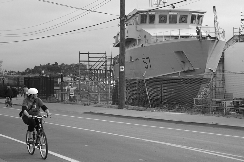
The Galloping Goose Trail, home of bicyclists and shipyards
At Banfield Park, the Galloping Goose crosses a trestle bridge, leaping to the other side of the harbor. We opt for a different route, departing from the trail to walk through quiet suburbs. The residents of Victoria, although firmly lodged in an urban setting, still maintain some country practices, an observation clearly buttressed by the beehives lodged on the roofs of select homes.
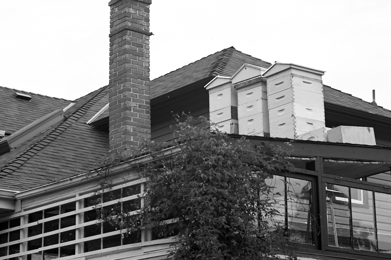
Urban beekeepers
Our destination, the northern end of our loop, was Esquimalt Gorge Park, which surrounds an inlet known as Gorge Waters. It was a lovely — and on a Friday morning — empty park. A pleasant walkway parallels the water. At the southern end of the park are the famous "Reversing Falls," a short course of rapids over which the tidal waters flow. When the tide is flooding, the water runs north, over the falls. When it ebbs, the falls run south. A neat party trick.
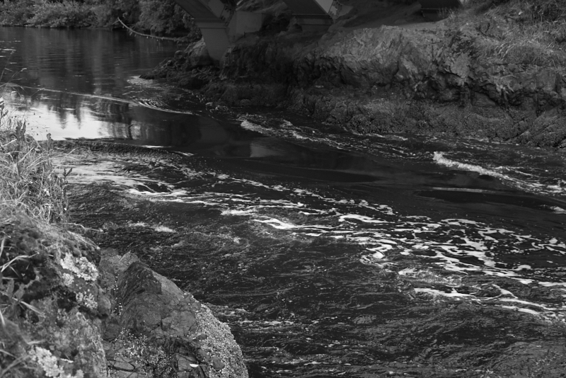
The reversing falls of Esquimalt Gorge
We cross the Gorge at this point, and head back along city streets. Eventually we rejoin the Galloping Goose Trail and close the loop. The trail passes over the water at the Selkirk Trestle Bridge. To the left, alone in the center of the water, stands Halkett Island, a sacred site for First Nations people. This small stump of a rock was a cemetery island for the Songhees tribe. Over the centuries, a certain number of subsurface graves were carved out of the rock, but most bodies were placed in wooden burial boxes aboveground. The cemetery island had been the last resting place of tribal leaders since long before the arrival of the Europeans. This came to an end in 1867, when four young British lads swam out to the island and set it on fire. Their prank destroyed the cemetery, turning the wooden monuments into smoke and ash.
Sigh.
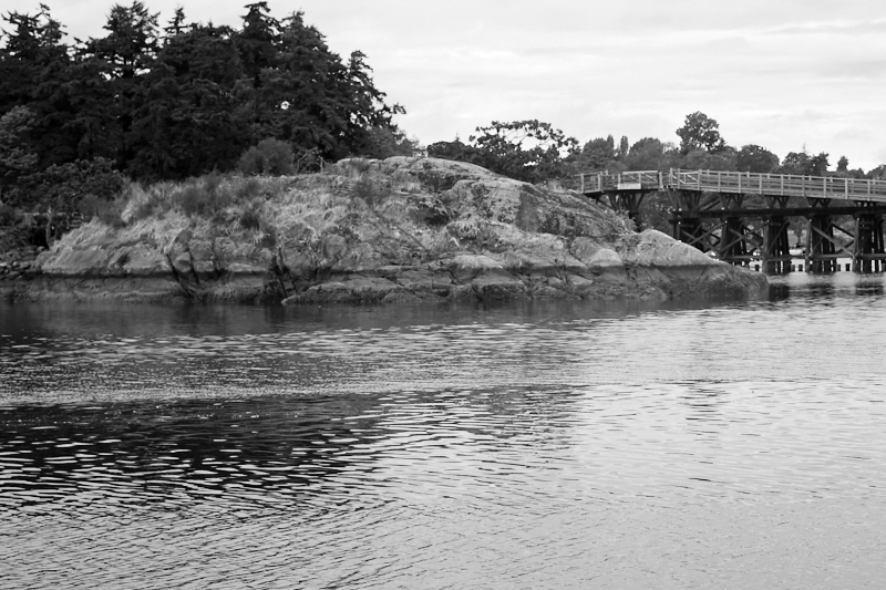
Halkett Island, an ancient burial ground
As we complete our hike, I attempt to gather my thoughts about this city. Victoria feels young, environmentally conscious, and alive with energy. It has a quirky charm, an independent spirit that may be explained by its separation from the mainland. The seat of provincial government, it lives in a symbiotic relationship with the Salish Sea, encircled and penetrated by salt water. Its residents play in, on, and around the water. At its core, it is a maritime city, one whose boats are not a pretty, archaic decoration to bewitch the tourists — this is a working port with harbors, shipyards, and a people who look to the sea for material and spiritual sustenance.
Born and raised on the western edge of the United States, I feel a particular affinity for this lovely city. I like the smell of the sea and the raucous discourse of grey-morning gulls. Even though it is a tourist destination, we never felt crowded. The city handles its visitors well. From the upscale, tea-sloshed Empress Hotel, to the free hikes on the Galloping Goose Trail, there is something for every interest, and every budget, in Victoria.
Before departing to resume our trip around the Salish Sea, we drove to the southern edge of the city. Here, where Victoria runs into the Strait of Juan de Fuca, Douglas Street intersects with Dallas. Standing alone in a grassy spot near the end of the road is a marker — Mile One of the Trans-Canada Highway. 4,990 miles of highway originates here, running from Victoria, through all ten Canadian provinces, and terminating in St. John's Newfoundland on the Atlantic coast. As I stand before the sign to take a picture, a familiar tingle surges from my itchy feet: wouldn't it be an epic adventure to travel the entire length of Canada on the TCH? I climb back into my car. Not today, but perhaps soon. We pull out of our parking spot and begin the much shorter journey to Ucluelet, rolling through the first miles of the TCH, from Victoria to Nanaimo.
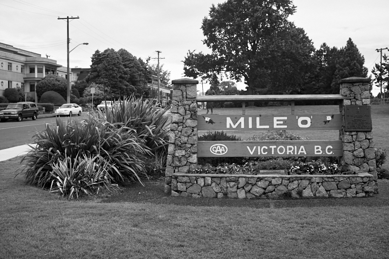
Mile Zero, the beginning of the Trans-Canada Highway
I leave Victoria with unanswered questions. What, for instance, is "bubble tea?" There were numerous signs advertising this mystery drink, but I never quite got around to trying it. Will the Johnson Street Bridge be replaced, or will a barge smash its supplanter? How many chucks could a wood chuck chuck if the wood chuck chucked all day?
There is no more time for questions today; if I am ever to have these issues resolved, I will have to return.
If you are enjoying this series, why not subscribe to Richard's monthly newsletter, What's New in Old News? The Peripatetic Historian is on the road, roaming the world and compiling fresh adventures. Don't miss out. Click here to join the legions of above-average readers who have already subscribed.